There are many maps of Africa that illustrate geographic features, linguistic groupings, colonial landscapes, or modern countries, and beyond. This tool is directed at historical periods between circa 1500 and 1900, for which there are few inland maps other than depictions often based on incomplete or inaccurate information drawn up from hearsay and speculation. The aim here is to provide a basic geographic understanding of the continent and its peoples from perspectives rooted in African and African diaspora history.
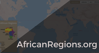
AfricanRegions.org is helpful for researching and teaching this continent’s complex history in broad, regional terms. It centers on a geographic hierarchy that divides Africa into six broad regions that are sub-divided into 34 subregions, including major offshore islands. By definition, a region is an area or division with definable characteristics but not always fixed boundaries. Design concepts here attempt to portray fluid, fuzzy, and non-linear edges, which are difficult to represent on an interactive map. In essence, loose borders shift depending on historical contexts, interpretations, and periods.